Caesar Creek Gorge
- wilfredadesigns
- Jun 11, 2021
- 5 min read
Updated: May 25, 2024
Caesar Creek Gorge

Waynesville, OH 43215
"Never be in a hurry; do everything quietly and in calm spirit. Do not lose your inner peace for anything whatsoever, even if your whole world seems upset." ~ Saint Francis de Sales
Caesar Creek Gorge

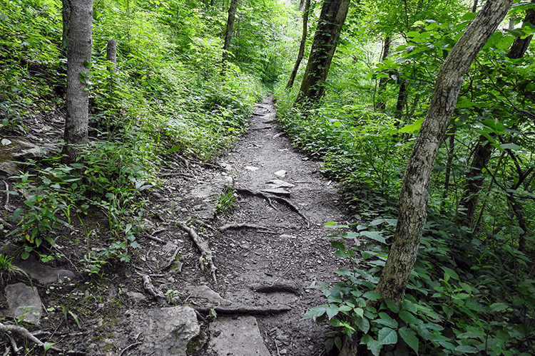
The Caesar Creek Gorge is a small part of the Caesar Creek State Park. The gorge has a short 1.2-mile trail that winds through the wooded area next to the gorge. There is also access to the Caesar Creek Gorge State Nature Preserve.
Below is a copy of the Caesar Creek State Park Map.
Gorge Loop Trail

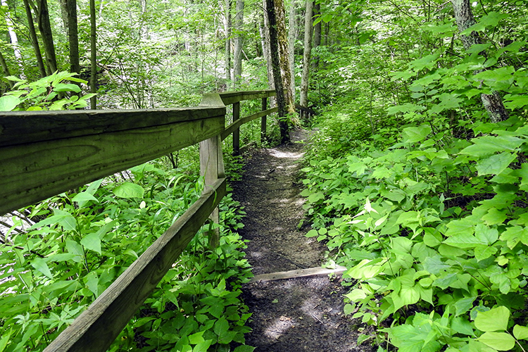
The trail in the park is both paved and natural. It is a moderate walk that includes a lot of steps. If you go right once you walk across the O’Neall Road Bridge, you will have to walk up the steps. If you choose to go left, you will get to go down the steps.
Steps, steps and more steps... Did we happen to mention there are a lot of steps?
There are approximately 1.2 miles of trail with a 160’ incline.
A few footbridges are located along the path.
When we visited the park, there were a few cars, but it was not crowded. We only passed one person on the trail. The others were sitting near the water enjoying the view.
Caesar Creek Gorge State Nature Preserve
You can enter the State nature Preserve Trail from the Gorge Loop Trail. It is located to the right of the O’Neall Road Bridge, just past the first set of steps.
The State Nature Preserve is a restricted area. You cannot leave the trail without a permit. If you want to fish, you must have a valid permit. And fishing is only permitted during daylight hours.
Even though dogs are allowed on the George Loop Trail, they are not allowed on the Caesar Creek Gorge State Nature Preserve trail.
Fossil Hunting at the Caesar Creek Spillway

The Caesar Creek Spillway is accessible by the Caesar Creek Gorge Loop Trail. Fossil collecting is permitted at the spillway if you have a permit. The permits are free at the visitor center.
The area is famous for the number of fossils that can be found there. You can take the fossils you find home as long as they are not bigger than the palm of your hand. If you find larger fossils, they need to be left where they are. Also, if you find a fossil that looks as though it is of importance, you are asked to leave it where it is and notify a ranger. This helps ensure the fossil can be studied, and no damage is incurred. If the fossil is determined to be important, it will then be removed. Then it can be displayed at a museum or other institution.

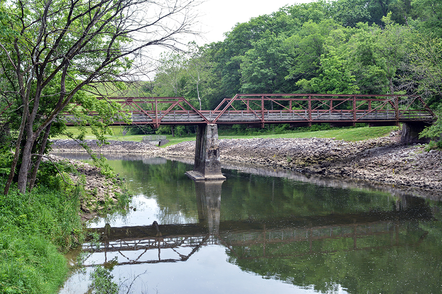
The O'Neall Road Bridge


The O'Neall Bridge sign says:
A Bridge to Our Past…
Converting coal into iron and steel was a hot, dirty and dangerous process. It employed miners, railroaders, barge workers and mill workers along mountains, valleys and riverways of Appalachia.
Business was booming in the late 1800s through the mid 1900s. Steel mills created products that built our nation., including rail to expand railroads from coast to coast, plows to convert vacant fields into productive farmland, and structural beams for burgeoning towns and cities.
Steel was loaded into barges and distributed throughout the country using the Ohio River navigation system which is still maintained by the U.S. Army Corps of Engineers today.
Steel was also used to build bridges that cross bays, rivers and even quiet creeks.
Built in 1921 at a cost of $1237.00, the O’Neall Road bridge is a fine example of an economical design that was prevalent from the 1840s through the early twentieth century. Two types of trusses are used in its design. Can you spot the difference?
A Pony Truss has side that extend above he decking, but are not connected across the top. This is visible when standing at either end of the bridge. It is also the shorter of the two spans.
A Pratt Truss has vertical members and diagonals that stops toward the center on the sides, and the sides, and the sides are connected across the top of the bridge. It is the taller and longer of the two spans.
Two steel companies fabricated the beams for the bridge. Can you find the Insignia? Both companies were located in eastern Pennsylvania.
Canoe/Kayak Launch
There is a canoe/kayak launch located near the rear of the parking lot close to the shelter house.

Parking Lot & Shelter House
There is a large paved parking lot that has ADA parking available. The parking lot sits next to the O’Neall Road Bride. There is a wooden deck at the parking lot that overlooks Caesar Creek. There is also a large shelter house that can be reserved by contacting the U.S. Army Corps of Engineers at (513) 897-1050.
Our Thoughts
This is a very nice park that is well-kept. We did not spot any trash at all. There are several things to do from walking, boating, fishing, picnicking, to birdwatching.
The trail is short, but if you are looking for a quick walk, it is perfect. And the steps give you quite the workout.
What You Can Expect at Caesar Creek Gorge
Please note that trail rules and regulations can change at any time. The following information was in effect for Caesar Creek Gorge in Waynesville as of June 2021.


There are bathrooms located across from the O'Neall Bridge.

Bicycles are not permitted on the trail.

There was very little bird activity.

2 large steel bridges and several wooden foot bridges.

Concealed carry is permitted.

Dogs are allowed on the Gorge Loop Trail. They are not permitted on the Caesar Creek Gorge State Nature Preserve Trail.

Trail surfaces are natural, blacktop and wood. There are a lot of steps.

There is a lot of parking available.

Picnic tables are located at the shelter house.

There is no playground.

There are benches on the stairs. And on the deck that overlooks Caesar Creek.

Quite a bit of shade.

1 large shelter house that can be reserved by calling the Army Corps of Engineers at (513) 897-1050.

Trails is marked.

There are trash bins located by the shelter house and in the parking lot.

Caesar Creek and a small wetland area located off the blacktopped area of the path.

A few ADA parking spots.


